1935
United States (federal program; maps for 200+ cities) · On map
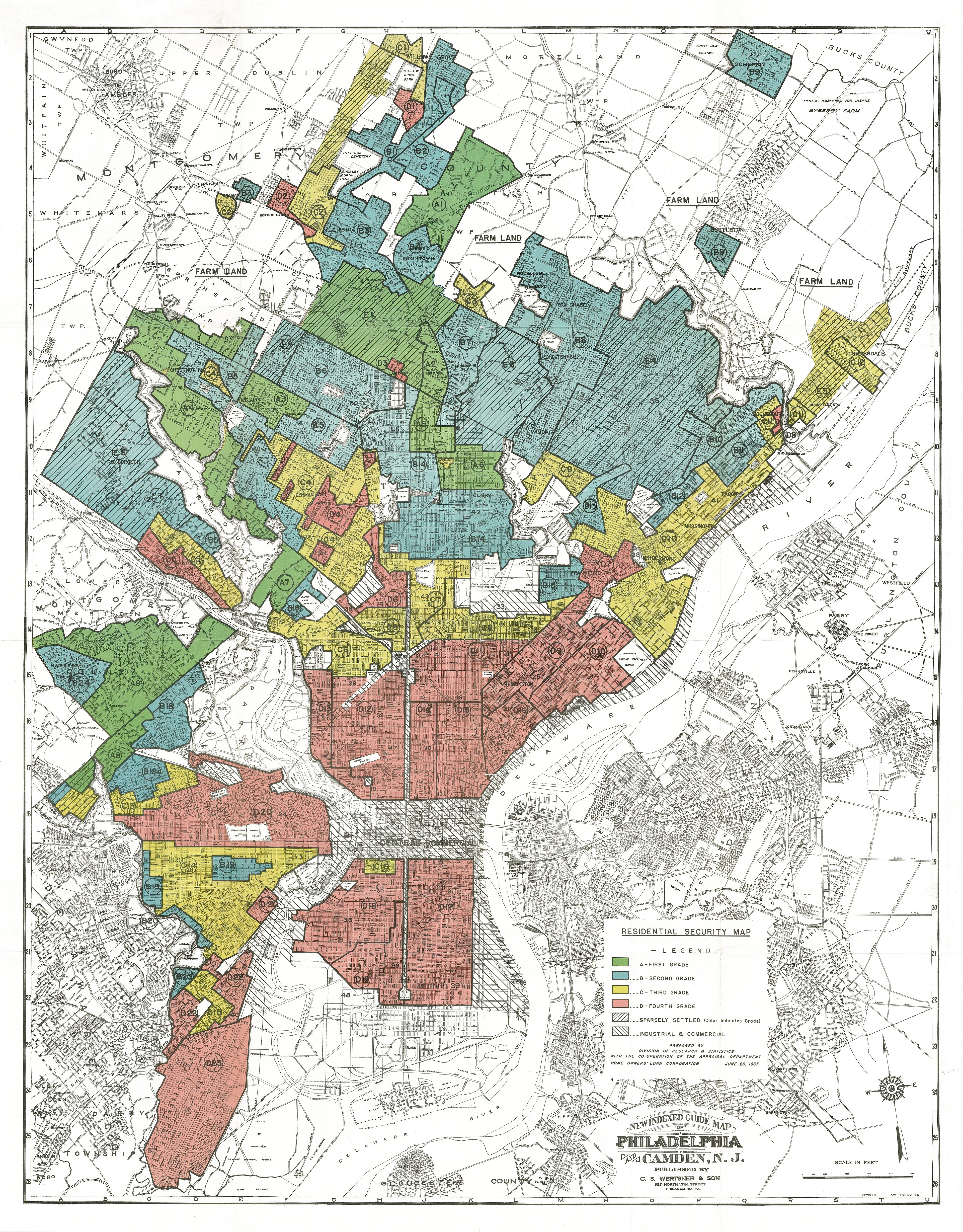
The federal Home Owners' Loan Corporation produced 'Residential Security' maps grading neighborhoods; 'D' areas were often redlined, excluding Black borrowers and shaping decades of segregated wealth. Documented by the Mapping Inequality project and historians.